
River Camping Safety: Campsite Selection, Overnight Gauge Spikes & Flash Flood Precautions
Essential rules for riverside camping: identifying high-water marks, securing boats against nocturnal dam releases, sandbar collapse risks, and flood escapes.
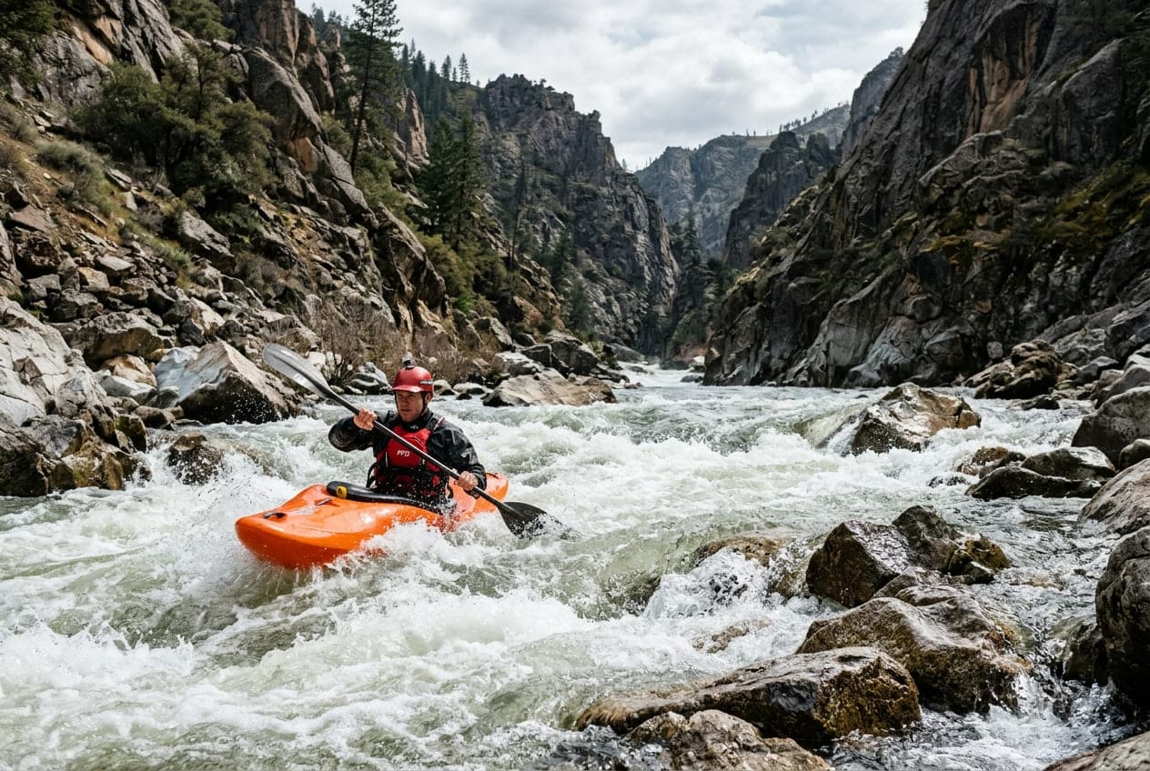
There is nothing quite like pulling your raft, canoe, or kayak onto an empty river sandbar at dusk, lighting a campfire on the gravel, and falling asleep to the steady hum of moving water under a canopy of stars. Multi-day river expeditions—from the canyon corridors of the Colorado and Green Rivers to the forested bends of the Ozarks and Appalachians—are the pinnacle of wilderness adventure.
Yet, riverside camping carries a unique, life-threatening danger: the river never stops moving, and water levels can surge dramatically while you are asleep.
Whether triggered by sudden upstream thunderstorm runoff or scheduled midnight hydropeaking releases from hydroelectric dams, unwary campers who pitch their tents on low beaches risk waking up in chest-deep water with their boats and gear washed miles downstream.
Here is the ultimate guide to river camping safety, reading high-water indicators, securing watercraft, and avoiding nocturnal flood traps.
Reading the Riverbank: How to Find the True High-Water Mark
When arriving at a potential campsite in late afternoon, never assume the current waterline is permanent. You must spend five minutes reading the landscape to identify the river's recent high-water mark:
- The Flotsam and Drift Line: Walk up the bank away from the water. Look for lines of dried pine needles, river reeds, dried foam scum, or driftwood deposited in linear rows. This debris marks the exact crest of the most recent high-water event.
- Mud Caked on Trees and Boulders: Inspect the trunks of willow trees, alders, and canyon walls. A distinct horizontal line of dried silt or water stains indicates where the river stage reached recently.
- Vegetative Margins: Notice where terrestrial vegetation begins. If ground is covered in bare, unrooted silt or wet river gravel, that area is inundated regularly. Set your camp above the perennial grass, sagebrush, or mature tree line.
- Scour Marks on Canyon Walls: In desert canyons, look for the "bathtub ring"—a distinct dark mineral varnish line or polished rock face where scouring flood currents frequently strip away desert patina.
Nocturnal Hydropeaking: The Dam Release Surprise
If you are camping along a tailwater river below a hydroelectric dam, water levels are not dictated by local weather—they are controlled by regional electrical demand and grid operators.
- The Hydropeaking Cycle: Power companies ramp up dam generation during peak air-conditioning hours or to meet industrial grid spikes. Depending on how many miles downstream your campsite is, that released pulse of water can take 6 to 12 hours to travel downriver.
- The Midnight Surge: It is common for dams to release water at 4:00 PM, resulting in a sudden 3-to-6 foot stage rise reaching your campsite at 2:00 AM while your group is sound asleep.
- The Rule of Elevation: On any regulated tailwater, never pitch a tent or store gear less than 6 to 8 vertical feet above the evening waterline, regardless of how calm and dry the evening weather appears.
Sandbar Hazards: Liquefaction, Calving & Undercut Banks
River sandbars look inviting: they offer flat, soft ground and easy boat landings. However, alluvial sand deposits in moving water are inherently unstable geological formations:
1. Bank Calving & Undercut Banks
Rivers constantly cut into sediment on the outside of bends. What looks like a firm, grassy 4-foot ledge can be severely undercut by swift currents below the surface. Walking near the edge can cause hundreds of pounds of sand to sheer off into the river without warning. Never pitch a tent within 10 feet of a shear drop-off.
2. Saturated Sandbar Liquefaction
When river stage rises even a few inches, water permeates the porous sand from underneath (hydraulic head pressure). A sandbar that felt rock-hard at 7:00 PM can turn into soft, waterlogged quicksand by midnight, causing tent stakes to pull out in the wind and sleeping pads to float inside tent floors.
Campsite Selection Matrix
| Campsite Location | Flood Risk | Escape Route Viability | Safety Recommendation |
|---|---|---|---|
| Low Mid-River Sandbar | Very High | None (Surrounded by deep water) | Emergency Stop Only: Avoid overnight camping. Easily overwhelmed by minor 1-foot stage rises. |
| Inside River Bend (Gravel Bar) | Moderate | Fair (Gradual slope uphill) | Acceptable in Stable Weather: Wide, gently sloped terrain allows water to spread without rapid depth spikes. Pitch tents on the highest bench. |
| Outside River Bend (Cutbank) | High | Poor (Eroding steep banks, sweepers) | Do Not Camp: Fast currents erode banks continuously; high risk of falling timber and bank collapse. |
| Elevated River Terrace / Forested Bench | Lowest | Excellent (Clear path to high ground) | The Gold Standard: Mature trees indicate ground has not flooded in decades. Always camp on elevated benches when available. |
The Two-Point Tie-Off: Securing Watercraft Overnight
Waking up to find your raft or canoe has vanished into the downstream mist is an expedition nightmare that leaves groups stranded in remote wilderness.
Never simply drag your boat onto the sand and walk away:
- Pull the Boat Completely Clear of the Water: Do not leave boats half-floating where overnight chop and rising current can gently bump them loose.
- The Primary Bow Painter: Tie a heavy-duty, 30-to-50-foot painter rope securely around a mature tree trunk or deep bedrock horn. Use a secure knot like a bowline or round turn with two half-hitches.
- The Secondary Redundant Anchor: In barren gravel bars with no trees, drive a heavy steel sand stake or deadman anchor deep into dry gravel, and secure a second cam-strap tether to a different thwart.
- Stow the Oars and Paddles: Always remove oars from oarlocks, take paddles out of canoes, and store them securely high up inside your camp. If a rogue wave sloshes against your boat, unsecured oars will float away first.
Nighttime Protocols & Flash Flood Escape Routes
In canyon country (such as the Green River, Grand Canyon, or desert southwest), flash floods can surge with terrifying speed:
- Always Scout Your Uphill Exit in Daylight: Before setting up your tent, identify your physical escape route. If the river surges 10 feet in the dark, can you climb out of the canyon bench without ropes or rock climbing gear? If you are boxed into a vertical canyon slot with no uphill terrace, move downstream to a wider basin.
- Keep Headlamps and Shoes Inside the Tent: Never leave river sandals or headlamps outside your tent vestibule where rising water or nocturnal wind can sweep them away. Keep your headlamp around your neck or in the tent mesh pocket, and shoes right at the zipper door.
- Establish a River Gauge Stick: Before going to bed, push a stick into the sand right at the current water edge. Check it before you sleep. If the water has advanced up the stick by even two inches without rain, the river is rising—wake the camp and evaluate conditions.
Leave No Trace in the River Corridor
Because rivers concentrate outdoor recreation into narrow geographic ribbons, practicing strict Leave No Trace (LNT) principles preserves fragile riparian habitats:
- Pack Out All Human Waste: On popular river corridors, carrying a portable groover (self-contained toilet system) or WAG bags is legally mandated. Never bury human waste in river sandbars where changing water levels expose it downstream.
- Fire Pans and Ash Disposal: Build fires only inside elevated metal fire pans with fire blankets underneath to catch hot embers. Never leave char marks on canyon bedrock or scorched sand. Pack out cold ashes.
- Micro-Trash and Strainers: Kitchen food scraps attract bears, raccoons, and rodents. Use a fine-mesh kitchen strainer to catch food particles when washing dishes, and pack all solids out in sealed trash bags.
Check Live Stage Trends Before Launching
A safe multi-day river trip starts with accurate hydrological intelligence.
Always review upstream and downstream USGS streamgages, hydrograph trends, and flood alerts on ClearGauge before pushing off. Know whether upstream reservoirs are holding water or releasing pulses, keep your boats securely tethered, and enjoy a safe night along the water!
Want to see this in action? Check real-time river conditions near you.
Explore All Rivers →