
Tailwaters vs. Freestone Rivers: How Dam Releases and Hydropeaking Shape Water Levels
The crucial differences between free-flowing freestones and dam-controlled tailwaters. How bottom-release dams, hydropeaking, and release schedules dictate river flows.
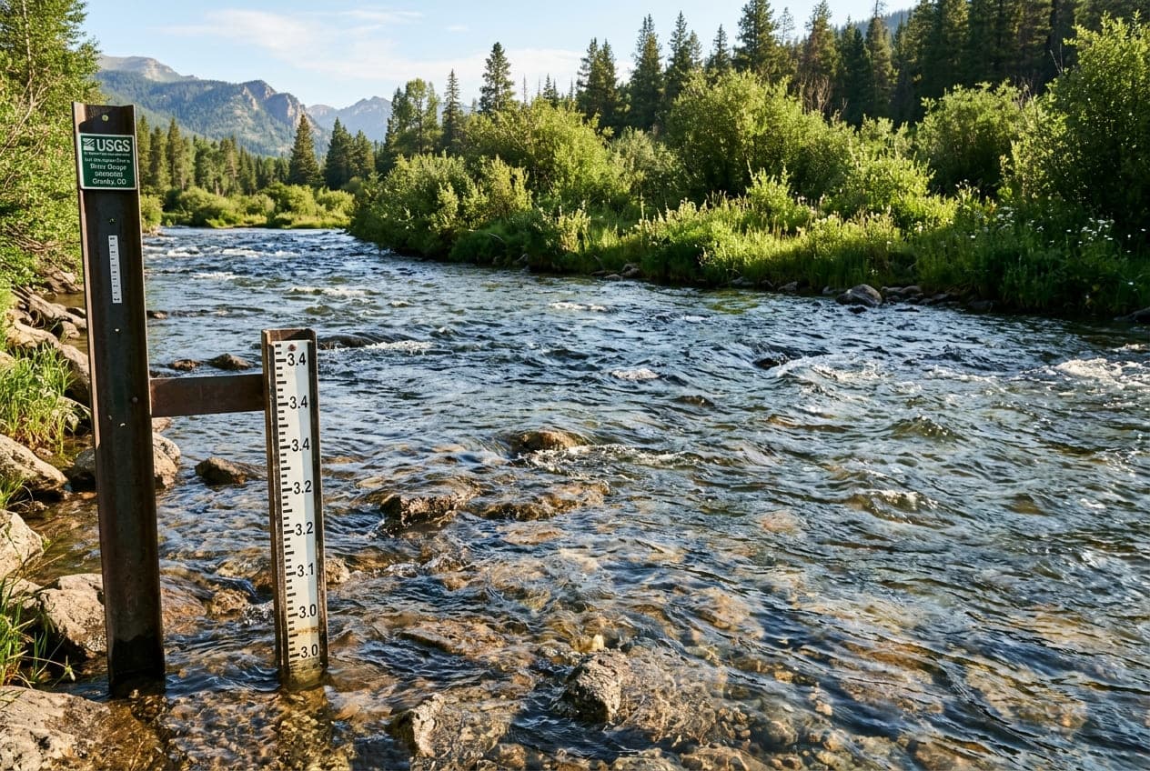
When looking up river conditions on a USGS streamgage, one of the first questions an experienced paddler, angler, or hydrologist asks is: "Is this a freestone river or a tailwater?"
The answer completely changes how you interpret the numbers. A 500 CFS surge on a freestone river usually means a rainstorm swept through the mountains. But that exact same 500 CFS surge on a tailwater might happen on a cloudless, 85°F Tuesday afternoon with not a single drop of rain in sight.
Understanding the fundamental divide between freestones and tailwaters is essential for predicting water clarity, anticipating sudden flow surges, and staying safe on the river.
What is a Freestone River?
A freestone river is a free-flowing, undammed natural waterway whose discharge and water levels are governed entirely by Mother Nature.
The name "freestone" comes from the loose, shifting gravel, cobblestones, and boulders that form the riverbed. Because there are no dams to halt natural sediment transport, high spring floods freely tumble and rearrange the riverbed rocks year after year.
Characteristics of Freestone Rivers:
- Precipitation-Driven: Flow rates (CFS) rise and fall in direct response to rainfall events and spring mountain snowmelt.
- Seasonal Temperature Swings: Water temperatures fluctuate dramatically with the seasons—freezing or near-freezing in winter, cool in spring, and warming significantly during late summer heatwaves.
- Bell-Curve Hydrographs: When rain falls, a freestone hydrograph shows a classic, gradual bell-shaped curve: a steady rising limb as tributaries drain, a smooth peak, and a gradual falling recession limb as water drains away over several days.
- Famous Examples: The Middle Fork of the Salmon (ID), Gallatin River (MT), Arkansas River through Browns Canyon (CO), and the Gauley River headwaters (WV).
What is a Tailwater?
A tailwater is a section of river located immediately downstream of a dam or reservoir. Its flows, water depth, and temperatures are dictated not by immediate rainfall, but by civil engineers and dam operators controlling mechanical release valves, spillway gates, and hydroelectric turbines.
While tailwaters can receive runoff from downstream tributary streams, the main channel flow is artificial.
Bottom-Release (Hypolimnion) vs. Top-Release (Epilimnion) Dams
The depth from which water is released out of the reservoir dramatically affects the river ecology:
- Bottom-Release Dams (Deep Hypolimnion): Water is drawn from the bottom of deep reservoirs (often 100+ feet below the surface). This water remains at a near-constant temperature of 45°F to 55°F (7°C to 13°C) all year round, regardless of whether the air outside is 10°F in January or 95°F in July.
- The Angler Advantage: Because bottom-release tailwaters never freeze in winter and rarely overheat in summer, they create world-renowned trout fisheries with massive insect hatches (e.g., the Green River below Flaming Gorge, the San Juan below Navajo Dam, and the White River in Arkansas).
- Top-Release Dams (Epilimnion): Water spills over the top or from shallow intake towers. During summer, this water has been heated by the sun and can be much warmer, sometimes stressing cold-water fish downstream.
What is Hydropeaking?
The most critical operational dynamic on tailwaters is hydropeaking (also known as "peaking power generation").
Hydroelectric dams are often used as "peaking plants." Unlike nuclear or coal facilities that run at a steady baseline, hydro turbines can be ramped up to maximum output in minutes. Power grid operators turn on the turbines when electrical demand peaks—usually:
- Summer afternoons: When millions of homes turn on air conditioning.
- Winter mornings and evenings: When heating and lighting loads spike.
The Pulse Wave and the "Square-Wave" Hydrograph
When dam operators open the gates to generate power, the river does not rise gradually. It produces a distinct "square-wave" hydrograph:
Discharge (CFS)
    ▲
4000│          ┌──────────────────────┐   <- Hydropeaking Power Surge
    │          │                      │
    │          │                      │
 500│──────────┘                      └────────── <- Baseflow Generation
    └─────────────────────────────────────────► Time (Hours)
The graph jumps vertically in minutes from 500 CFS to 4,000 CFS, runs completely flat for several hours during peak power generation, and then drops straight back down once the gates close.
The Downstream Lag Time
A sudden dam release travels downstream as a distinct hydraulic wave, called a pulse wave.
If a dam releases water at 1:00 PM, an angler or kayaker sitting 5 miles downstream might not see the water rise until 2:30 PM. But when that wave arrives, the water level can rise several feet in just 10 to 15 minutes.
Tailwaters vs. Freestones: Side-by-Side Comparison
| Feature | Freestone Rivers | Tailwater Rivers |
|---|---|---|
| Flow Regulator | Rain, snowpack, groundwater | Dam operators, spillways, hydro turbines |
| Water Temperature | Varies widely by season (32°F–75°F) | Often cold and stable year-round (45°F–55°F) |
| Hydrograph Shape | Smooth, gradual bell curves | Sharp, stepped "square-wave" patterns |
| Summer Water Clarity | Can blow out during summer rainstorms | Often clear below the dam (reservoir settles silt) |
| Ice Formation | Can freeze solid or form anchor ice | Often stays ice-free for miles below bottom-release dams |
| Flash Flood Hazards | Driven by sudden watershed cloudbursts | Driven by turbine start-ups and scheduled gate releases |
Essential Tailwater Safety Rules
Because tailwaters can surge rapidly without warning, outdoor recreationists must follow specific safety precautions:
1. Check Dam Generation Schedules Before You Go
Most major dam operating authorities publish projected daily generation schedules online:
- TVA (Tennessee Valley Authority): Publishes hourly turbine projections for rivers like the Clinch, South Holston, and Hiwassee.
- USACE (U.S. Army Corps of Engineers): Publishes release schedules for flood control reservoirs nationwide.
- Bureau of Reclamation / Utility Providers: Regularly post release alerts for Western rivers.
Always compare published utility schedules with live USGS streamgage readings on ClearGauge before stepping into the water.
2. Never Camp or Park Below the High-Water Mark
If you are gravel-bar camping on a tailwater river, look closely at the shoreline. Note the line of dry silt, bleached driftwood, and wet vegetation. Never pitch a tent, leave a kayak unanchored, or park a vehicle below the high-water stain line. An unannounced midnight dam release can flood your campsite in minutes.
3. Place a "Stick Gauge" When Wading
If you are wade fishing or relaxing on a river sandbar:
- Push a stick firmly into the mud right at the water's edge when you arrive.
- Glance back at your stick every 15 minutes.
- If you see the water creeping up the stick, wade back to the main bank immediately. Do not wait to catch "just one more fish." A minor gravel bar can quickly transform into a deep, impassable side-channel, leaving you stranded on an island in heavy current.
4. Listen for Warning Sirens
Many dams feature audible warning sirens and flashing strobe lights positioned along the first few miles of the river corridor. If you hear a loud horn or siren sound, it means turbine gates are opening and water is rising rapidly. Exit the riverbed immediately.
Summary: Mastering the River You Run
Knowing whether a river is a tailwater or a freestone is the secret to timing your trips:
- Choose freestones in early spring and late autumn for wild, natural flows, and watch out for spring runoff mud.
- Rely on tailwaters during late-summer heatwaves when freestones are low and warm, but stay vigilant against sudden hydropeaking surges.
Use ClearGauge to monitor real-time trends, gauge heights, and historical medians across all active US river gauges before your next trip.
Want to see this in action? Check real-time river conditions near you.
Explore All Rivers →